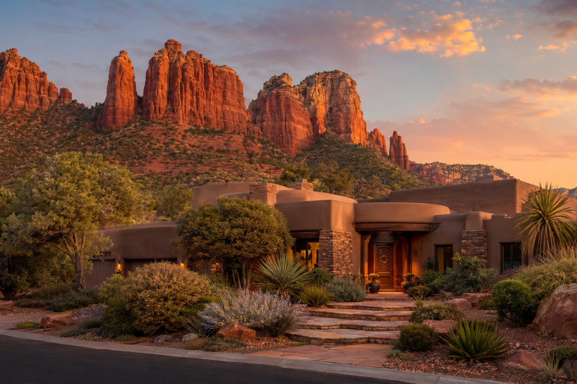
There are people who have lived in Sedona, Arizona for five years and have never driven the full length of Red Rock Loop Road. It sits outside the city limits, south and west of Highway 89A, wrapping around the base of Cathedral Rock through a landscape that most visitors experience only as a photograph. The highway does not go through it. The tourist corridor bypasses it entirely. The properties along this road are not resort properties, not vacation rental complexes, not new development. They are residential addresses in one of the quieter and more geographically distinctive corridors in the Sedona real estate market.
The gap between the Red Rock Loop’s reputation and the daily reality of living there is significant in both directions. The reputation undersells the visual drama of the address. The reality clarifies trade-offs that the photographs omit.
What Red Rock Loop Is and Where It Is Precisely
The Red Rock Loop is a distinct Sedona area community outside the city limits, generally bounded by Highway 89A to the north, the Coconino National Forest to the south and west, and the Sedona city boundary to the east. The area is served by Yavapai County rather than the City of Sedona, which affects tax structure, regulatory oversight, and some service levels.
Red Rock Loop Road is the primary road through this area, running roughly southwest from its junction with Upper Red Rock Loop Road and Back O’ Beyond Road near Highway 179, curving around the western and southern approaches to Cathedral Rock, and rejoining Highway 89A via Lower Red Rock Loop Road. The full loop drive is approximately 7 to 8 miles. Properties sit on both sides of the road in varying density, with the creek-corridor eastern section and the formation-view western section having distinct characters.
The address is not technically Sedona city. Depending on the specific parcel, properties may carry a Sedona, Arizona mailing address while being in unincorporated Yavapai County jurisdiction. This is a detail that has practical implications for property taxes, short-term rental regulations, and some utility infrastructure.
What the Properties Are Actually Like
Red Rock Loop properties tend toward larger lots than comparable properties in West Sedona or the Chapel Area. The area developed without the same density constraints that apply within city limits. Lot sizes of 1 to 3 acres are common. Some parcels along the creek corridor on the eastern section of the loop have direct Oak Creek frontage, which represents one of the rarest residential amenity combinations in the Sedona market: formation views and private creek access on the same parcel.
Home styles across the Red Rock Loop range considerably. Some sections have mid-century ranch-style residences built when the area was first developed in the 1960s and 1970s. Others have been significantly updated or replaced with contemporary construction. Some of the most architecturally notable private residences in Sedona are on Red Rock Loop Road parcels, positioned to maximize Cathedral Rock views from outdoor living spaces. The variance in home condition and design within the corridor is wider than most buyers expect before they drive it.
The price range reflects this variance. Entry-level properties on the Red Rock Loop, typically older homes with limited updates on smaller lots without premium view positions, start below the broader Sedona market median. Premium properties on Cathedral Rock view parcels with updated construction and large lots push well into the luxury range. The spread between the lower and upper end of the Red Rock Loop market is wider than almost any other single Sedona neighborhood.
What Daily Life Here Actually Looks Like
Red Rock Loop residents are approximately 10 to 15 minutes from West Sedona’s grocery stores, pharmacies, restaurants, and services via Highway 89A. This is a practical daily commute for errands and shopping. There is no walkable commercial area within the Red Rock Loop itself. The character of the area is genuinely rural in feel, despite the proximity to Sedona services.
The daily payoff is direct access to the Cathedral Rock trail network, Crescent Moon Ranch, Red Rock State Park, and Oak Creek without driving to a trailhead. Residents who prioritize daily trail use can walk from some properties directly to the Cathedral Rock and Baldwin trails. Properties within the Back O’ Beyond Road section are nearest to these specific access points.
The visual environment from a Red Rock Loop residence is fundamentally different from what any other Sedona address delivers. From the west and south sides of the loop, Cathedral Rock is visible at close range from a perspective that the formation photographs most people have seen do not capture. The formation appears not as a distant landmark but as a geological feature that is genuinely present in the daily environment. This is the experiential element that drives the address premium for buyers who have seen it in person.
Jurisdictional and Infrastructure Considerations
The Red Rock Loop’s location outside Sedona city limits creates practical considerations that buyers must understand before purchasing. Short-term rental regulations in Yavapai County differ from those within the City of Sedona. Some Red Rock Loop communities have HOA CC&Rs that restrict or prohibit short-term rentals independently of county rules. Buyers with short-term rental intentions must verify the applicable rules for any specific parcel before closing.
Utility infrastructure varies significantly across the Red Rock Loop corridor. Properties on the eastern section near the city boundary generally have city water and sewer connections available. Properties farther along the western and southern sections more commonly use private wells and septic systems. The cost difference between a serviced parcel and one requiring private well and septic is significant and affects both the purchase economics and the ongoing ownership costs.
Flood zone designations apply to some Red Rock Loop parcels, particularly those with Oak Creek frontage or proximity to the creek corridor. FEMA flood zone status should be confirmed for any specific parcel as part of standard due diligence. Properties in Special Flood Hazard Areas require flood insurance for financed purchases.
Who Buys in the Red Rock Loop and Why
The buyer profile that consistently gravitates toward the Red Rock Loop in Sedona, Arizona is distinct from the buyers who choose West Sedona’s amenity-rich neighborhoods or the Chapel Area’s gallery-and-views corridor. Red Rock Loop buyers typically prioritize quiet over walkability, space over proximity, and direct formation access over commercial convenience. Many are making a deliberate choice to be away from the tourist traffic of Highway 179 and Uptown while remaining close enough to Sedona’s services to function practically.
Some Red Rock Loop buyers are specifically looking for Oak Creek frontage, which narrows the search to a small subset of parcels in this corridor. Others are looking for Cathedral Rock view positions without the Chapel Area price premiums. Still others want protected land adjacency, possible with National Forest and Red Rock State Park bordering parts of the corridor. Angelo Davis, REALTOR® at RE/MAX Sedona, understands these distinct buyer motivations and monitors Red Rock Loop inventory specifically for clients who have identified this area as their target.
Frequently Asked Questions
What is Red Rock Loop in Sedona, Arizona?
Red Rock Loop is a residential community area outside Sedona city limits, generally in unincorporated Yavapai County, that wraps around the Cathedral Rock formation via Red Rock Loop Road. The area is bounded by National Forest land on multiple sides and includes properties along Oak Creek’s south bank, one of the few Sedona residential corridors with direct creek frontage available.
How far is Red Rock Loop from Uptown Sedona?
Red Rock Loop in Sedona, Arizona is approximately 5 to 8 miles from Uptown Sedona depending on which section of the loop the property is in. The drive takes 10 to 15 minutes via Highway 89A and the loop road approaches. The area is also accessible from Highway 179 via Back O’ Beyond Road.
Are there short-term rental restrictions in Red Rock Loop Sedona?
Red Rock Loop properties in Sedona, Arizona fall under Yavapai County jurisdiction rather than City of Sedona regulations. Yavapai County has different short-term rental rules than the city. Additionally, some communities within the Red Rock Loop area have HOA CC&Rs that independently restrict or prohibit short-term rentals. Buyers must verify the applicable rules for any specific parcel before purchasing with rental intentions.
Do Red Rock Loop properties use city water and sewer in Sedona?
Utility connections on the Red Rock Loop in Sedona, Arizona vary significantly by location. Properties on the eastern section near the city boundary generally have city utility access. Properties farther along the western and southern sections more commonly use private wells and septic systems. Utility connection status must be verified for any specific parcel as part of due diligence.
What are home prices like in Red Rock Loop Sedona?
Red Rock Loop home prices in Sedona, Arizona range broadly. Entry-level properties on smaller lots without premium views start below the broader Sedona market median. Premium Cathedral Rock view properties with large lots and updated construction push well into the luxury range. The price spread within the Red Rock Loop corridor is wider than most other Sedona neighborhoods due to the variation in lot size, view quality, and home condition.
Is there Oak Creek frontage available on Red Rock Loop?
Yes. Some Red Rock Loop properties in Sedona, Arizona have direct Oak Creek frontage on the eastern section of the corridor where the creek flows parallel to the road. Oak Creek frontage represents one of the rarest residential amenity categories in Sedona, and Red Rock Loop is one of the primary locations where it is available. Frontage parcels carry a significant premium and turn over infrequently.
—
If you are evaluating the Red Rock Loop corridor and want a current picture of what is available, what the realistic build and utility costs are for undeveloped parcels, and which specific addresses deliver the formation view position you are looking for, get a current market analysis or reach out directly to discuss this area.
