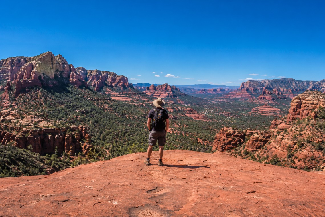
The name Chicken Point is not ironic. It is a description, and it is accurate. The promontory at the end of the Broken Arrow trail in Sedona, Arizona sits on the rim of a sheer red rock drop with a 360-degree view that includes Cathedral Rock, Bell Rock, the Mogollon Rim, and on clear days the San Francisco Peaks near Flagstaff. Every year, a meaningful percentage of hikers who complete the trail to this point stand at the ledge, look down, and decide they have seen enough from where they are standing. That is a completely reasonable decision.
The hikers who walk to the edge are experiencing something different. Not just the view, which is genuinely exceptional, but the specific vertigo of standing on a small sandstone peninsula with exposure on three sides. It is the kind of thing that is hard to explain to someone who has not done it.
Where Broken Arrow Is and How to Get There
Broken Arrow Trail is located in the Chapel Area of Sedona, Arizona, accessed via Morgan Road off Highway 179. From the Y intersection head south on 179 approximately 2.5 miles, turn left onto Morgan Road, and continue approximately 0.7 miles to the trailhead parking area. The Red Rock Pass is required for parking at $5 per vehicle. The America the Beautiful annual pass is accepted.
One important practical note for planning: Broken Arrow trail is also shared with permitted off-road vehicle tours. Pink Jeep Tours and a handful of other permitted operators run tours on this trail, particularly to Chicken Point. On weekday mornings the trail typically has minimal vehicle traffic. On busy weekend days and in the late morning and afternoon hours, jeep tour vehicles will be on the trail simultaneously with hikers. The vehicles are driven responsibly and the trail is wide enough in most sections for hikers and jeeps to pass, but it is worth knowing before you go. Early morning starts minimize the overlap.
The Trail: Distance, Terrain, and What Slickrock Actually Means
Broken Arrow is approximately 3.3 miles round trip with about 350 feet of elevation gain. The distance is modest. The experience is not, primarily because the terrain underfoot is different from most Sedona trails.
Slickrock is the term used in the Southwest for the smooth, bare sandstone surface that defines the Chapel Area landscape and much of the Broken Arrow trail. The name is misleading: on dry days, sandstone provides excellent grip for trail shoes and even bare feet due to its granular surface texture. The friction coefficient of dry sandstone against rubber is remarkably high. Hikers who approach it carefully and confidently find it more secure underfoot than gravel or loose dirt.
The challenge with slickrock is that it offers no predefined path. Where dirt trails have a worn track, slickrock has cairns: small stacked rock markers placed by land managers and well-intentioned hikers that indicate the route. The cairns on Broken Arrow are reasonably reliable but should be followed attentively. In a few sections the route crosses open slickrock where the next cairn is not immediately visible. The standard approach is to pause and scan rather than forge ahead. The trail never becomes genuinely navigable for cairn-following purposes.
The trail alternates between open slickrock, sections of loose red dirt between rock features, and occasional juniper groves where the route narrows into a conventional footpath. The variety is part of what makes Broken Arrow a different hiking experience from the canyon corridors or formation scrambles that characterize most Sedona trails.
Chicken Point: What It Actually Is and What the View Delivers
Chicken Point is a sandstone promontory at approximately the 1.5-mile mark of the Broken Arrow trail in Sedona’s Chapel Area, Arizona. The formation juts out from the main ridge with sheer drops on three sides. The exposed ledge where hikers and jeep tour passengers stand for photographs is roughly 20 feet wide and 40 feet long. The surface is solid and flat. The exposure is significant.
The view from Chicken Point is specific and worth describing. Cathedral Rock sits directly south, at a distance that shows the full vertical profile of the formation against the sky. The view angle from Chicken Point is one that reveals Cathedral Rock’s east face in a way that the more common Buddha Beach photograph does not. Bell Rock and the Courthouse Butte formation are visible to the southeast, and the Village of Oak Creek corridor extends south along Highway 179 below. The Verde Valley floor is visible beyond, dropping away from Sedona’s high desert elevation. The Mogollon Rim defines the northern horizon.
On days with good visibility, the San Francisco Peaks near Flagstaff are visible as a slightly elevated profile above the rim. At 12,633 feet, the Peaks are Arizona’s highest point and visible from remarkable distances across the Colorado Plateau.
This 360-degree view is one of the broadest single viewpoints accessible on foot from any Chapel Area trail. The Bell Rock Pathway provides views of Bell Rock but not the west-facing Cathedral Rock profile. Little Horse trail reaches Cathedral Rock but from a different angle. Chicken Point provides the synthesis, a single vantage point where the full Chapel Area formation landscape is simultaneously visible.
The Scramble Steps: What to Expect at the Final Approach
The final approach to Chicken Point involves a short but unmistakable sequence of natural sandstone steps cut by erosion and worn smooth by foot traffic. The steps are roughly 18 to 24 inches each in height. There are approximately 8 to 10 of them. Hands are useful for balance on a few of the higher steps but are not strictly required for most adults.
After the steps, the slickrock surface slopes slightly toward the promontory. The exposure builds gradually rather than presenting itself all at once. The mental calibration happens during the approach rather than at a single decisive moment. This is actually how the psychology of height works in most outdoor situations: gradual exposure is more manageable than sudden exposure.
Some visitors find the descending steps on the return trip more challenging than the ascent. This is common with any exposed step climbing. Taking the descent slowly and facing the rock surface rather than looking down the slope makes it more secure.
Broken Arrow in the Context of the Chapel Area Trail Network
Broken Arrow connects to the broader Chapel Area trail network, which includes Little Horse, the Bell Rock Pathway, the Templeton trail, and several connector trails that allow extended loops through the formation landscape. Hikers who complete Broken Arrow to Chicken Point and want more trail time can connect to Little Horse and continue toward Cathedral Rock on a longer route.
The Chapel Area trail network is distinct from the West Sedona trail systems in several respects. The terrain is primarily slickrock rather than canyon floor or sandy wash. The formations are closer and at more varied orientations, which makes the trail experience more visually dynamic per mile. The trailheads are generally closer to Highway 179 and to the Village of Oak Creek, which creates different parking dynamics than the more remote West Sedona trailheads.
Chapel Area Properties and Trail Access
The Broken Arrow trailhead on Morgan Road is one of the most accessible in the Chapel Area, Sedona, Arizona. Properties along Morgan Road and the adjacent Chapel Hills community are within a few minutes of the trailhead. Buyers evaluating the Chapel Area specifically for trail access regularly ask about Broken Arrow proximity, and the Morgan Road corridor is the answer.
Angelo Davis, REALTOR® at RE/MAX Sedona, has worked extensively in the Chapel Area and understands which specific streets within the neighborhood deliver the combination of formation views and trail proximity that many buyers are seeking. The Chapel Area is not a homogeneous neighborhood: the back roads off Morgan and Chapel Road provide a quieter character than the Highway 179 corridor, and they sit closest to both the Broken Arrow trailhead and the Bell Rock Pathway network.
Frequently Asked Questions
How long is Broken Arrow trail in Sedona?
Broken Arrow trail in Sedona, Arizona is approximately 3.3 miles round trip with about 350 feet of elevation gain. Most hikers complete the full trail including time at Chicken Point in 2 to 2.5 hours. The slickrock terrain requires more attentiveness than the distance alone suggests, particularly for first-time visitors to sandstone trail navigation.
What is Chicken Point on Broken Arrow trail Sedona?
Chicken Point is a sandstone promontory at approximately the 1.5-mile mark of Broken Arrow trail in Sedona’s Chapel Area, Arizona. It sits on the edge of a sheer red rock drop with a 360-degree view including Cathedral Rock, Bell Rock, the Mogollon Rim, and the Verde Valley below. The name reflects the choice hikers face at the exposed ledge.
Do you need a permit for Broken Arrow trail in Sedona?
Broken Arrow trail in Sedona, Arizona does not require an advance hiking permit as of 2026. The trailhead parking area on Morgan Road requires the Red Rock Pass at $5 per vehicle. The America the Beautiful annual pass covers this fee.
Is Broken Arrow trail dog friendly in Sedona?
Dogs are permitted on Broken Arrow trail in Sedona, Arizona on a leash no longer than 6 feet. The slickrock terrain is manageable for most dogs on dry days. The exposed ledge at Chicken Point requires careful management with large or energetic dogs given the drop on three sides.
Is Broken Arrow trail difficult in Sedona?
Broken Arrow is rated moderate in Sedona, Arizona. The distance and elevation gain are modest. The slickrock navigation requires following cairns attentively rather than a worn path. The psychological challenge is the exposed ledge at Chicken Point, not the physical difficulty of reaching it. The approach scramble steps are accessible for most adults in reasonable fitness.
Are there jeeps on Broken Arrow trail in Sedona?
Yes. Broken Arrow trail in Sedona, Arizona is shared with permitted off-road vehicle tours including Pink Jeep Tours. Tour vehicles operate primarily in the morning and afternoon hours on peak season days. Early morning weekday visits minimize the overlap with tour traffic. The trail is wide enough in most sections for hikers and vehicles to pass safely.
—
If you are considering the Chapel Area as a place to buy and want to understand which streets deliver the most direct trail access alongside the neighborhood’s formation views, explore Chapel Area homes for sale with that lens in mind.
